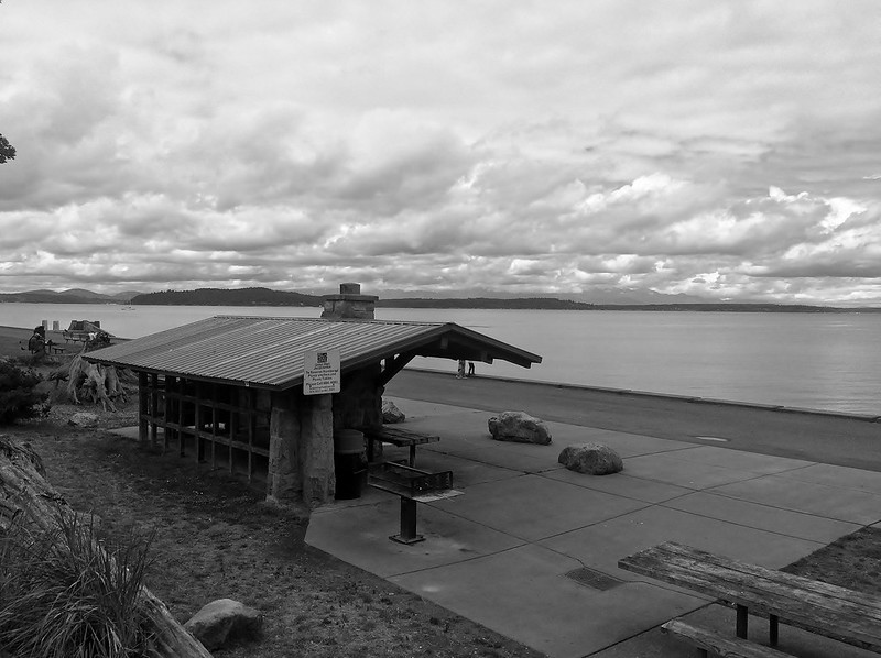
“Seattle in Black & White: Alki Beach I” by JoeInSouthernCA is licensed under CC BY-ND 2.0.
Last week, there was a two-day stretch of summer-like weather in Seattle, and all I could think about was the beach. Swimming has always been one of my favorite summer activities. I grew up spending parts of the summer on Massachusetts’s South Shore, swimming in temperate water on sandy ocean beaches. When I moved to Seattle, I knew I was giving up convenient access to beaches like that. In the last few years, I’ve adjusted my expectations and come to appreciate the rocky shores of Lake Washington and the exhilarating cold of Puget Sound. I no longer let the comparison to the beaches of my childhood impede my enjoyment of the beaches of Seattle. A second impediment remains, this one in the built environment, rather than the natural one. Serving the beaches of Seattle does not appear to be a priority for the agencies that operate transit in the city.
To demonstrate this, I ran three new access analyses of 30-minute transit and walking access in Seattle: weekday service, Saturday service, and Sunday service. These analyses divide Seattle into an 80 meter by 80 meter grid of sectors, and determine how easily one can reach each sector. This is done by counting the number of possible journeys—a combination of origin sector, destination sector, and starting time—that can be made using transit and walking in 30 minutes or less, and then considering how many journeys contain a given sector as the origin or destination. To more easily demonstrate how each sector ranks in terms of the overall quality of transit in Seattle, the map displays a z score for each sector. Seeing how easy it is to reach a beach from an arbitrary point in the city is just a matter at looking at the z scores of the sectors that comprise it.
Some properties of beaches will cause them to have impeded access. Most sectors can be reached on all four of their sides. Because beaches border water, beach sectors will have at least one direction from which they cannot be accessed. This reduces the number of origin points that have direct routes to them. Additionally, a beach might be in a difficult location to serve by vehicle, such as at the base of a sheer cliff. I don’t think that this entirely excuses exceptionally poor transit access, though. If there is parking nearby, which many of the beaches in Seattle have, a transit stop nearby should be possible as well. Serving them poorly by transit seems to be a choice rather than a matter of impossibility.
I chose the beaches to analyze fairly arbitrarily. I didn’t limit the list to guarded beaches, but I didn’t include every tiny public shore either. I also chose a single sector to represent each beach, even though some beaches are comprised of many sectors. Typically, I selected a sector that did have water access, and were the least isolated part of the beach.
The access maps linked earlier in this piece are useful for following along with the next three sections. The text box under the “Select Sector” heading accepts the numeric sector ids in the tables below, showing precisely which sector represents each beach. Clicking the sector while it is already selected will show an access map that is centered on that sector, rather than the full network access map.
Beaches on Lake Washington
| Beach | Sector | Weekday | Saturday | Sunday |
|---|---|---|---|---|
| Matthews Beach | 27950 | -0.3102 |
-0.2866 |
-0.3198 |
| Mount Baker Beach | 12120 | -0.3541 |
-0.3169 |
-0.3252 |
| Prichard Island Beach | 3356 | -0.8188 |
-0.7276 |
-0.7731 |
| Andrews Bay | 6870 | -0.9618 |
-0.8763 |
-0.8505 |
| Madrona Park | 14219 | -1.0971 |
-0.9702 |
-1.0774 |
| Denny Blaine Park | 15274 | -1.2551 |
-1.1779 |
-1.2171 |
| Madison Park | 17218 | -1.4273 |
-1.5174 |
-1.4531 |
| Magnuson Park | 24938 | -1.5472 |
-1.5540 |
-1.5455 |
While all of Seattle’s Lake Washington beaches have below average transit access, Matthews Beach and Mount Baker Beach are positive outliers. They accomplish this in similar, but slightly different ways. Matthews Beach Park is right off of Sand Point Way, and the frequent route 75 runs on that street. Route 75 connects to two Link stations at its ends, and many other bus routes on the way. Mount Baker Beach is a longer walk from routes 14, and 8, but these frequent routes allow a quicker Link connection, as well as connections to other bus routes. (Note that the most direct route to transit from Mount Baker Beach involves taking stairs. These access analyses use the same walking speed for stairs as flat ground. This will overstate access to Mount Baker Beach, particularly for those with mobility limitations.)
Contrast those with the considerably lower scores of Madrona Park and Madison Park. Both have bus routes that terminate at, or just after, the park. Transit service that ends at a location allows people to reach that destination from one direction only, unlike routes that pass by, which bring in passengers from two directions. Additionally, route 11, serving Madison Park, is less frequent than any of the aforementioned routes. Neither it, nor the route 2 that serves Madrona Park, gets particularly close to the Capitol Hill Link Station, despite heading in its general direction.
Magnuson Park has a confluence of transit routes near its entrance. If the beach were there, it would have, by far, the best transit access on this list. The remoteness of the beach eliminates the access benefit that the frequent transit confers. Transit service to the beach would not be impossible; there is vehicle access and parking near the beach, but buses do not enter the park. At the same time, the distance from transit stops doesn’t make it far less accessible than Madison Park Beach, which has transit directly to its doorstep.
Beaches on Puget Sound
| Beach | Sector | Weekday | Saturday | Sunday |
|---|---|---|---|---|
| Lowman Park | 4795 | -0.9443 |
-1.0049 |
-1.0204 |
| Golden Gardens | 26733 | -1.2158 |
-1.1542 |
-1.1538 |
| Alki Beach | 11347 | -1.3398 |
-1.3788 |
-1.3383 |
| Carkeek Park Beach | 29977 | -1.4840 |
-1.4366 |
-1.4359 |
| Discovery Park | 20972 | -1.8135 |
-1.7699 |
-1.7675 |
Every Puget Sound beach in Seattle has below average transit access, at best nearly one standard deviation below average. Compared to its peers, Lowman Park benefits from being a relatively short distance from the frequent C Line. The ranking of Golden Gardens above Alki Beach surprised me. Alki Beach has nearby transit service on route 50. Between Alki and the SODO Link Station, it runs at 15 minute frequencies most of the day. For 30-minute trips, though, the station appears to be too far away to have a meaningful impact. Meanwhile, Golden Gardens isn’t far from route 45 according to this analysis, but, in reality, making the connection is much more difficult since it is comprised almost entirely of stairs. Compare this to the experience of drivers, who have copious, free parking available.
Carkeek Park and Discovery Park ask a beachgoer to go down a single, long path to reach the beach. They are unlike Lowman Park or Alki Beach, which can be served by transit that passes by on nearby major roads. Still, it would be possible to run transit to these beaches—for both it is possible to park a car near the beach—but that is not the choice that was made.
Miscellaneous Beaches
| Beach | Sector | Weekday | Saturday | Sunday |
|---|---|---|---|---|
| Fritz Hedges Park | 19658 | 1.1960 |
1.3134 |
1.2917 |
| East Green Lake | 24998 | 0.9443 |
0.9602 |
1.0401 |
| West Green Lake | 25411 | 0.8701 |
0.8052 |
0.9193 |
| Haller Lake | 30885 | -0.2528 |
-0.2301 |
-0.2014 |
| Bitter Lake | 31520 | -0.4087 |
-0.3822 |
-0.3624 |
In Human Transit, public transit planning consultant Jarrett Walker extols the virtues of “being on the way.” Urban design that enables good transit access doesn’t put desirable destinations at the end of cul-de-sacs or on the far side of large surface parking lots; it puts them along paths to other destinations. That way, transit vehicles are not making detours to serve each destination.
Green Lake, Bitter Lake, and Haller Lake are geographic features, not the products of urban planning. Nevertheless, they are “on the way.” Being lakes in the interior of the city, rather than bodies of water at the edges, means that transit routes that serve other destinations serve these beaches incidentally. As a result, they represent some of the best transit access to beaches in Seattle.
The waterfront at Fritz Hedges Park is barely a beach. I’m not sure if the swim I took there amidst a miserable heat wave was strictly legal, owing to the waterway in which it is located. (Take a shower afterwards!) Its transit access is comparatively exceptional, though. The nature of its location, along a waterway but not isolated from city streets, makes it not dissimilar from Alki Beach or Madison Park Beach. Its far superior transit access demonstrates the promise of having an abundance of frequent transit routes nearby. It’s not impossible to have significantly above average transit access to a beach, but in Seattle, it appears to be a rarely made choice.
Bad Beach Access May Be Correctable
Throughout this post, I’ve characterized poor transit access to beaches as a choice. I don’t think of this choice as a malicious act, designed to keep beaches free of transit-using rabble. From the viewpoint of a transit agency, each destination served represents a tradeoff. Investing service hours in beach access could mean longer and less frequent trips to jobs or schools, which may be a difficult choice to defend. I feel that this view lacks nuance. Not every decision has to be a tradeoff when it comes to serving destinations. It is possible that some routing choices generate redundant service: in this case, multiple ways to get from an origin, to a destination, at a given time, within 30 minutes. If that’s the case, some of those service hours could be reallocated to serve a broader variety of destinations, without upsetting access to existing ones.
Comparing the access analyses for Saturday and Sunday service demonstrates this to an extent. There are fewer service hours on Sunday, but a greater number of completed 30 minute journeys. It’s hard to tell why this is: it could be minor routing variations, generally faster scheduled travel times due to reduced traffic, or just shifts in schedule that result in some fortuitous transfer opportunities. It reveals that an investment in transit service hours does not always yield an improved ability to reach destinations. The inverse may be true; the overall number of trips could be decreased and the same number of journeys might remain the same. Currently, I don’t have a systematic way to know in advance where service hours could be removed and reallocated without being consequential to existing trips (though I have a suspicion of one such place). Nevertheless, I see nothing wrong with making guesses, and checking the outcomes with access analyses.
As much as I love the beach, I know that it isn’t the most vital destination for human survival. But thinking about transit as a mechanism for accessing only the essentials is self-defeating and sad. The things that potentially make it a first-choice transportation mode—the financial savings it offers an individual, the reduced environmental impact, never having to devote any mental energy to the idea of parking ever again—get eclipsed when certain destinations, particularly enjoyable ones, seem out of reach. Is there a transit network for Seattle that provides better access to the beach without sacrificing existing access to other destinations? I’m honestly not sure, but there’s nothing that convinces me that the answer is no. With creative attempts at reallocating resources, and access analyses to verify the results, it seems possible that “public transit” could be the answer to the question “which way to the beach?”