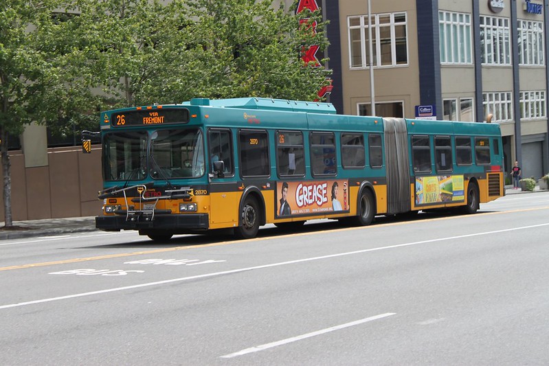
“KCM 2870 in SODO” by SounderBruce is licensed under CC BY-SA 2.0.
In 2015, I became fascinated by King County Metro’s efforts to restructure its bus network in anticipation of the opening of two new Link Light Rail stops. At the same time, I found out about isochrone maps and the larger idea of access in transit. While I was creating software to measure the latter, the former served as a motivator and test case. I hoped that I’d be able to evaluate Metro’s proposed alternatives, come up with some on my own, and present objective measurements of which was best. As Metro’s plans proceeded through a series of revisions, I followed along through the outreach materials that they produced. The process never felt very scientific, and that frustrated me, but I dreamed of a day where tools like the one I was building would make that so.
Six years later, three new Link stations are opening and again I’m looking through King County Metro’s outreach materials for a service restructure that they will be undertaking. My thought process is different now. Tools exist such that any transit agency that wants to could make and explain their decisions based on some measurement of access. Metro’s documents don’t do this, but in the end, the network is going to turn out fine. Metro is going to describe their choices in qualitative terms that demonstrate how a choice accomplishes the agency’s goals. While not the precise, analytically-focused reasoning that I’d like to see, most of the time the choices do appear to follow from goals that I largely support. I don’t expect to see anything truly appalling.
That made it disappointing to read this line from the outreach materials describing the replacement of the route 26 with a new route 20:
Reduce the amount of bus service along Thackeray Place NE and Latona Avenue NE, between NE 50th Street and NE 40th Street, where service is negatively affecting residents
This is a problem.
This Isn’t Personal
I don’t view the replacement of the route 26 as the problem, even though it results in a loss of transit service near me. The 26 uses the bus stop nearest to my home, and this change eliminates this stop altogether. Nevertheless, that’s not the part that bothers me.
I don’t find myself using the route 26 that much. Its typical frequency of 30 minutes makes it too infrequent to be useful most of the time. I rarely consider it as an option, even for trips to and from downtown, where it’s an obvious one-seat ride. There are plenty of other alternatives that run at higher frequencies and thus don’t put such a heavy constraint on when I can travel. I would have been absolutely shocked if Metro had preserved the 26 in full, or preserved any path downtown in its successor route. The 20’s routing south of NE 50th Street connects it with the new UDistrict Link Station, which fulfills the need for a path downtown. It’s a sensible routing choice.
For trips northbound from my home, I rarely use the route 26 either. I’m far more likely to walk to the more-frequent route 67. That being said, of these two directions, the 26 has been more useful to me traveling northbound. The 20 preserves and extends the 26’s route north of NE 50th Street. If I want to take the 20 northbound from my home I’ll easily be able walk to its stops north of NE 50th Street, only slightly further than I currently must do to catch the 26.
I am not grieving the loss of the 26’s path along Thackeray Place NE and Latona Avenue NE. It just doesn’t impact me that much and its replacement’s route is perfectly sensible. But that end result doesn’t excuse the dangerous reasoning that got there.
This is Dangerous Reasoning
I don’t know what feedback Metro received from residents of Thackeray Place NE and Latona Avenue NE that prompted this decision. I couldn’t find an explanation of the negative effects in Metro’s outreach documents. I live very close to the streets in question, and can’t think of anything that makes them more likely to be more negatively impacted than any other streets with transit service. Given this lack of information, I envision it could relate to a few broad categories: noise, safety, and stop activity.
Buses do make noise, though the buses that have been used on the 26, and will be used on the 20, are relatively quiet diesel electric hybrids. Thackeray and Latona are a couplet of one-way streets. Combining that with the fact that the 26 operates with at most 15-minute headways, residents must tolerate at most four buses per hour on their street. The vast majority of the day, 30-minute headways reduce this number to two. Meanwhile, two streets over from Latona on 5th Avenue NE, residents enjoy virtually no separation from Interstate 5, which provides an all-day din, punctuated by honking, engine braking, and inadequately muffled exhaust systems. I can’t imagine the Washington Department of Transportation being nearly as accommodating as Metro should residents of that street request the removal of this source of negative effects.
The low frequency of bus service also makes safety a minimal concern. At this frequency, bus volumes are dwarfed by car volumes. Two professionally-driven vehicles per hour hardly seems consequential, especially in the context of the immediate vicinity.
Perhaps the residents are less upset about the buses themselves, but the fact that there are bus stops on their street. Bus stops do mean that a resident may have strangers occasionally on the periphery of their property. Sometimes, they may make inconsiderate amounts of noise or leave garbage. I don’t deny the potential for nuisance.
At the same time, the effects are minor. They have simple mitigations. Garbage can be picked up; fences can emphasize the divide between public and private space. There’s nothing about them that are unique to Latona Avenue or Thackeray Place; there’s nothing about them that are unique to bus stops. These are annoyances that can occur anywhere that public amenities abut private space, not uncommon and unsolvable problems that threaten human existence. They’re not even a threat to property values: houses along these streets regularly sell for more than one million dollars.
Perhaps Metro is wise to reallocate transit service to places where residents appreciate it as an amenity. While there’s a superficial logic to this, it ignores other ways that transit service provides value. Yes, one goal of a transit route is to allow residents that live along that route to access their desired destinations. But a transit route is not a covenant between an agency and residents along the route. There are other parties to the agreement and their needs matter as well.
Those other parties are people who live elsewhere, but want to enjoy access to these streets. The portions of Latona Avenue NE and Thackeray Place NE in question aren’t streets that offer amenities in the traditional sense. As residential streets, they don’t provide considerable access to jobs, health care, or other services. They don’t provide access to any parks or traditional shared public spaces. I think it’s nevertheless wrong to view them as a place exclusively serving those who live along them. Sidewalks are public space. A walk through a neighborhood other than one’s own can be an enjoyable way to spend one’s time. A resident should not be able to restrict or hinder that just by virtue of the fact that their property abuts a public space.
Even if a street was entirely devoid of value to anyone other than the residents, hindering transit riders’ access to it still has consequences. A transit route forms a part of a network. Routes aren’t isolated conveyer belts that shuttle people to destinations along a path; they intersect. People need the ability to transfer between routes in order to access the full range of destinations that they desire to reach. Transferring necessarily involves riders temporarily inhabiting public space. For a public transit network to function, riders need to be welcomed in any neighborhood where a transfer can occur, not just those where their trips begin and end. When residents suggest actions that are hostile to the presence of people in the public spaces of their neighborhood, they prevent riders from maximizing the value that they could extract from a transit network. If Metro is willing to foreclose on providing direct access to an area to benefit residents, it must explain why this outweighs the loss of potential transfers.
Compared to other places, Latona Avenue NE and Thackeray Place NE do not offer the most valuable amenities or abundant transfer opportunities. Metro would be making a defensible choice to reallocate service such that more people have easier access to areas that offer more, at the cost of areas that offer less. The issue is that Metro did not frame its decision as making a routing choice that provided access to more amenities. They instead framed it as responding to the desires of residents, without regard to how the decision affected others. In response to minor nuisances, they gave those residents the power to hinder access to public space. That’s the problem.
What’s the Right Reaction?
While I see a clear problem in Metro’s explanation of replacing the route 26 with the 20, I’m less sure of what a satisfactory resolution is. It would be easy enough if I thought the decision Metro made was bad; I’d want Metro to revert it. My issue is with the process of arriving at that decision and the explanation of it. Undoing this change isn’t going to solve anything.
It’s also not really practical to expect that Metro can publicly criticize or explicitly say that it will ignore pieces of feedback from the public. I’d love to see a King County Metro that calls out people as crybabies when they speak of the very minor negative effects that transit service is causing in their safe and wealthy neighborhoods. This would be disastrous, though. To provide its present level of service, Metro depends on periodic tax levies that are decided by popular vote. My naive hope is that Metro, internally, does in fact give little weight to reports of negative effects like these, claims to act on them in the hopes of making people feel heard, but has other reasons for making the decision.
Even if that’s the case, seeing a decision explained this way upsets me. I believe that every transit agency, above all, ought to strive to give everyone easy access to whatever destinations they please. When I ride the transit network that Metro’s planners have produced, I feel as though our values are largely aligned. That sentiment is undercut when Metro frames a decision in terms of placating residents whose issues with transit service on their street don’t appear to rise beyond the level of minor nuisance. By explaining it in this way, Metro is empowering those who think that they ought to control who may use the public spaces on their street. In the case of replacing the route 26 with the 20 the end results don’t appear dire. I fear the harm this kind of decision making could cause under different circumstances. It’s a scary precedent.
Six years ago, I thought that the key to avoiding decision making that magnified loud and self-interested voices would be the availability of software that generated numeric measurements of access. Once it was possible to make these measurements easily, every transit agency would want to take the public feedback they received and use that measurement to filter out suggestions that would negatively impact access. Over time I’ve accepted that it’s more complicated than that, and I’ve become reluctant to insist that agencies evaluate their networks through this lens. In this case, though, I see a mode of decision making that fundamentally conflicts with the good that transit can provide. The residents of a street can’t be looked upon as the arbiters of whether transit service belongs there, regardless of their sentiment toward it. It’s an error to frame a decision in terms that normalize that perspective. Resolving the problem starts with King County Metro coming to see it in that way.